


General introduction to GMDSS
Global Maritime Distress and Safety System (GMDSS) has been developed by the maritime nations in the International Maritime Organization (IMO) and is the result of their adoption of amendments made in 1988 to the 1974 International Convention on the Safety of Life at Sea (SOLAS).
Based on recent developments in maritime communications, such as satellites and digital technology, GMDSS is designed to ensure maximum availability of safety-related communication for all passenger ships as well as for cargo vessels of 300 GT and upwards engaged in international voyages.*
The goal of GMDSS is to virtually guarantee that complying vessels will be able to communicate with an onshore station at any time, from any location, in case of distress or to exchange safety-related information.
*Ships below 300 gross tonnage as well as those that are not engaged in international voyages are subject to the requirements of the administrations of their flag states.
GMDSS Sea Area
GMDSS defines four sea areas based upon the location and capability of onshore-based communication facilities. The definition of the Sea Areas for GMDSS is outlined below.
Sea Area 
The radiotelephone coverage of VHF coast stations in which continuous alerting by Digital Selective Calling (DSC) is available.
Sea Area 
The radiotelephone coverage of MF coast stations in which continuous alerting by Digital Selective Calling is available.
Sea Area 
The coverage of Inmarsat geostationary satellites.
Sea Area 
Area outside A1, A2 and A3, mostly sea area around polar areas.
General functional requirements for GMDSS
- Transmission of ship-to-shore distress alerts by at least two separate and independent means, using different radiocommunication service;
- Reception of shore-to-ship distress alerts;
- Transmission/reception of ship-to-ship distress alerts;
- Transmission/reception of search and rescue co-ordinating communications;
- Transmission/reception of on-scene communications;
- Transmission/reception of SART signals for locating;
- Transmission/reception of maritime safety information;
- Transmission/reception of general radiocommunications to and from shore-based radio systems or networks; and
- Transmission/reception of bridge-to-bridge communications.
System suggestions for GMDSS
General requirement for equipment and functions for all ships irrespective of the operating sea area
-
Two-way VHF radiotelephone apparatus
At least two two-way VHF radiotelephone apparatus required for cargo ships of 300-500 GT
At least three two-way VHF radiotelephone apparatus required for all passenger ships and cargo ships of 500 GT and upwards -
Search and rescue locating device (SART: either by radar transponder operating in the 9 GHz band or AIS SART)
At least one SART required for cargo ships of 300-500 GT
At least two SART required for all passenger ships and cargo ships of 500 GT and upwards -
VHF radiotelephone with DSC and DSC Watch Receiver capable of:
‣ Transmission/reception of DSC on CH 70 (156.525 MHz);
‣ Transmission/reception of radiotelephony on CH 6 (156.300 MHz), CH 13 (156.650 MHz) and CH 16 (156.800 MHz); and
‣ Continuous watch on CH 70 (156.525 MHz) -
International NAVTEX Receiver
-
406 MHz EPIRB (Emergency Position Indicating Radio Beacon)
-
Inmarsat EGC receiver
Required if the ships operate within Inmarsat coverage but outside the international NAVTEX service area. However, ships operating exclusively in areas where an HF direct-printing telegraphy maritime safety information service is provided and fitted with equipment capable of receiving such service may be exempted from this requirement.
-
Permanently arranged electrical lighting for illuminating the control panel of the radiocommunications equipment
-
Automatic provision of position from an internal or external navigation sensor for all two-way communication equipment that includes ship's position in the distress alert
-
Arrangements required only for all passenger ships
-
Two-way radiotelephone for on-scene search and rescue communication using frequencies 121.5 MHz and 123.1 MHz
-
A distress panel at the conning position
If the satellite EPIRB is used as the secondary means of distress alerting and is not remotely activated, it is acceptable to have an additional EPIRB installed close to the conning position.
-
Automatic and continuous update of position for all relevant radiocommunication equipment to be included in the initial distress alert activated through the distress panel
-


Brochure Download
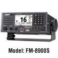
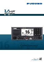 FM-8900S Brochure
(Update: Aug 3, 2018) FELCOM18, FELCOM19 Brochure
(Update: Jun 6, 2018) FS-1575, FS-2575, FS-5075 Brochure
(Update: Mar 5, 2018) GMDSS GUIDE
(Update: Oct 1, 2014) NX-700A, NX-700B Brochure
(Update: Oct 1, 2014) RC-1800T Brochure
(Update: Sep 17, 2015) DEEPSEA WORLD (For Merchant Marine)
(Update: Nov 6, 2019)